MAP OF FRANCE SHOWING THE REGIONS


France is split into regions, see above, then each region is split into departments. Below is a map of the Provence-Alpes-Cote d'Azur region showing its six departments.

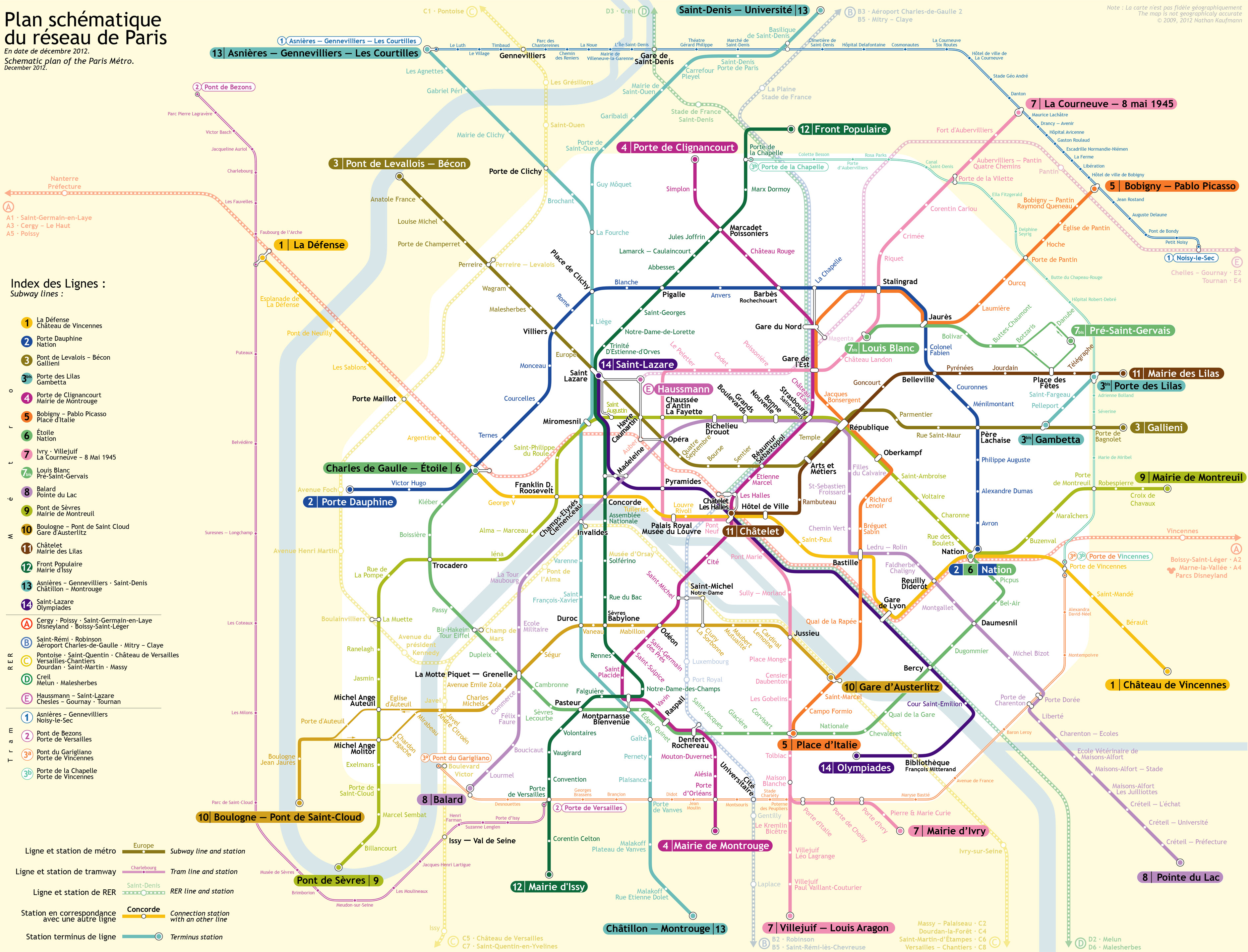
The Paris Metro
The metro is a very good way to travel around Paris. It is simple to use. Once you know the station you need to get to you need to find out which line number it is on. But it is extremely important that you work out which direction you need to travel in. You need to look on the map to find the last destination that the train you want is going to. So if for example you are at the Gare du Nord and you want to get to the Gare de l'Est you will see that both stations are on line 4, which is deep purple, so you look from the Gare du Nord on the map run your eyes past the Gare de l'Est and see that the end of the line is Porte d'Orleans, so that's the direction you want!In the metro stations there are lots of signs pointing to the different directions, so you follow the sign which says Porte d'Orleans, (remembering it's line 4) all very simple. Once you know that you can work out how to get all over the place, changing trains wherever you need to.
Link here to the Paris Metro Map
